Travel Diary: Michigan, Part 2
Before driving into the Upper Peninsula, we made a stop at Old Mackinaw Point Lighthouse in Mackinaw City. Founded in 1889, this lighthouse is at the junction of Lake Huron and Lake Michigan. We took a very informative tour of the grounds, which included a VERY LOUD sounding of the fog horn.

Old Mackinaw Point Lighthouse.
Our next stop included a ferry boat ride from Mackinaw City to Mackinac Island, a little island in the middle of Lake Huron. The island keeps its turn-of-the-century charm by not allowing automobiles. Some people rent a bike when they get to the island, but that, honestly, looked like a mess. We opted to walk around the island and see what it had to offer. One of the main attractions there is the Grand Hotel. It boasts the world’s longest front porch. They do charge a fee to enter the hotel and check out the porch, BUT…you may or may not be able to walk to the far end of the porch and enter the hotel there (wink, wink). The island is a great place to grab a bite to eat and to do some relaxing. We recommend skipping most of the stores here, they are tourist traps. Do NOT, however, skip the fudge shops. The fudge here is no joke.

A view of Mackinac Island from the ferry.


Cuttin’ fudge at Murdick’s.
A short ferry ride back and we were buckled in Brakayla heading across the Mackinac Bridge. This suspension bridge is the only way to drive into the UP. We drove to our most favorite camp of our trip — a free campsite in Hiawatha National Forest located on Search Bay. Inside this area of Hiawatha National Forest is a number of free dispersed campsites that have nice, flat sites, water views and, most importantly, peace and quiet. My only gripe is the bugs. Everywhere bugs. Flies, mosquitos, gnats. It made it hard to enjoy our area with so many bugs trying to get at us. After the sun started to go down, it seems they laid off us for a bit. We were finally able to sit outside with a couple of beers and enjoy the view.

The Mighty Mac.

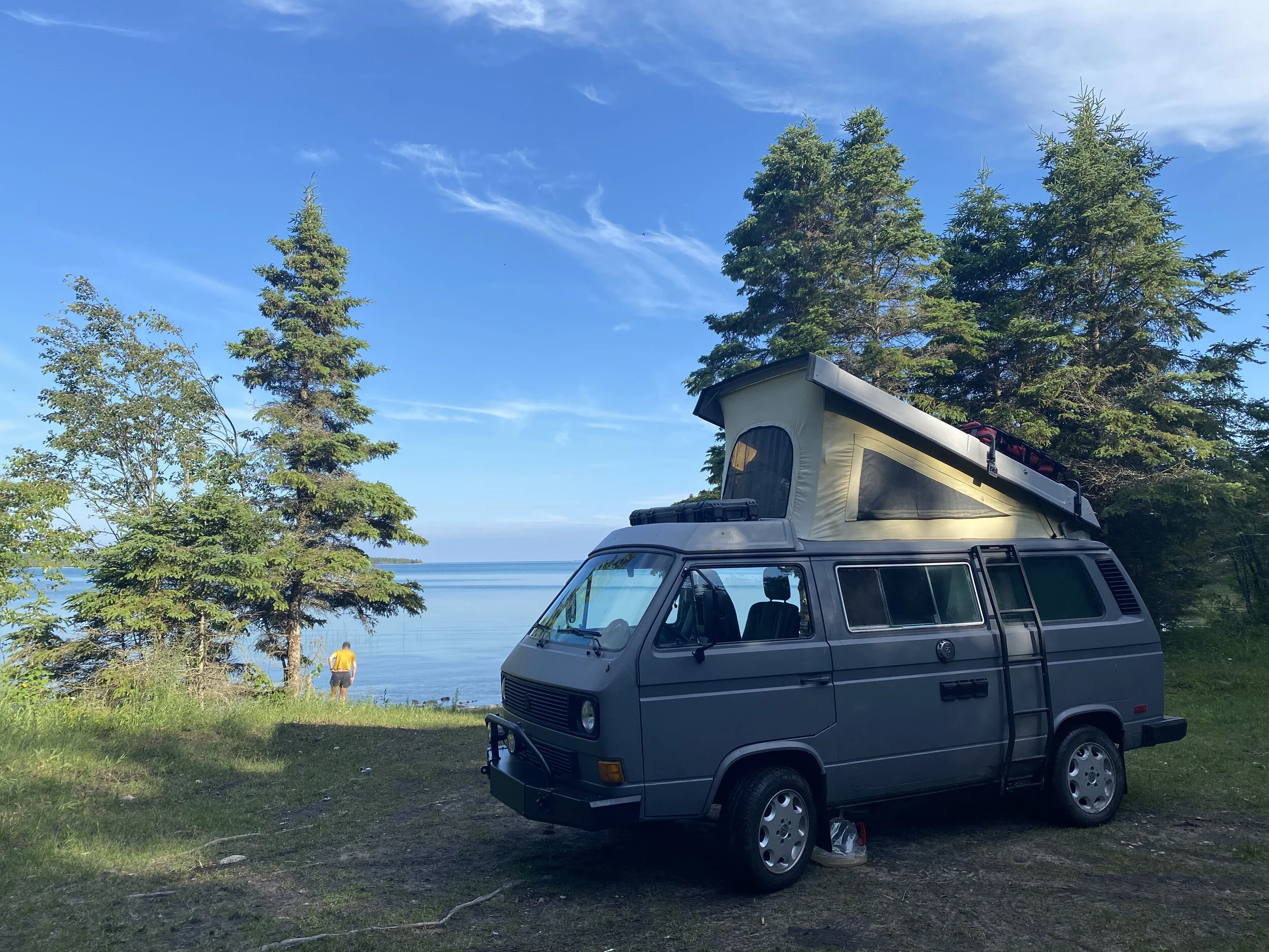
It was oh so quiet here.
Driving out of Search Bay, we headed north toward Whitefish Point on Lake Superior. With Michigan’s many lighthouses, you can imagine that in the not so long ago before modern technology, these waters could be treacherous to navigate. Hence, the Great Lakes Shipwreck Museum was a must-visit for us. Here, we became very acquainted with Gordon Lightfoot’s song “The Wreck of the Edmund Fitzgerald.” They have it on loop in the museum. There are some really cool artifacts and stories from shipwrecks on display there. Of course, there is also a lighthouse on site that can be toured. We highly recommend a stop here.

Great Lakes Shipwreck Museum and Whitefish Point Lighthouse.
Next on the agenda was Tahquamenon Falls State Park. Of course, there is a waterfall here. There are two, actually (Upper and Lower Falls). This state park also has a brewery (because everything in Michigan has a brewery). We highly recommend this as a stop to get a bite to eat and have a beer. It definitely exceeded our expectations.
From there, we drove to Pictured Rocks National Lakeshore. We had originally planned to take a boat tour here. Due to the amount of fog and rain in the area, we decided against that and ended up touring around in the van. The water is here is just as what you see in the pictures, very blue and very clear. This area is on our list of things to go back and visit in the future.
The small city of Munising was just down the road. A stop for a pasty was in order for dinner. If you’ve never had one, this is a full meal in your hand. Think “Hot Pockets, but better.” After eating by the lake, we decided it was time to find camp for the night. We headed into another part of Hiawatha National Forest and ended up driving around for almost two hours looking for a site. When we say people are camping more and more, we mean it! This was the middle of the week in July. Almost every site we passed was filled with people. We finally found a spot that was secluded. Next to Deer Creek, this site would have been perfect for someone kayaking due to the steps dropping into the creek. We set things up, made friends with all the bugs, and finally had a shower.

Upper Tahquamenon Falls.

Au Sable Light at Pictured Rocks.
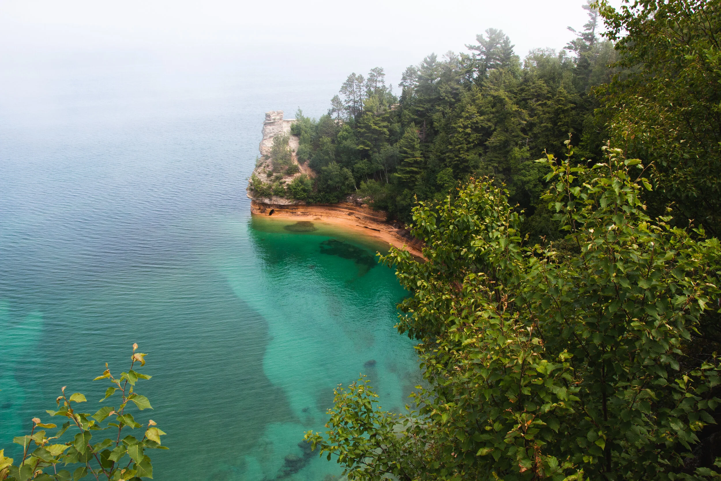
Pictured Rocks National Lakeshore.

Enjoying a very filling pasty by the water.
Marquette is the most populated city in the UP with about 21,000 people. Needless to say, there were many things to do here. But, it’s still very small compared to most large cities. We decided to do a little shopping down their Main Street and, of course, visit a brewery. We chose to have a brew at Ore Dock Brewing, which is located downtown. While chilling in their small, cozy taproom, we took some time to regroup and figure out where we were headed to next. Before we left town, we stopped at Thill and Sons Fish House for some smoked fish and smoked fish dip. We would make a trip back to Marquette just to get a taste of the fish dip again. It’s that good.

Ore Dock in Marquette.

After our fill of beer and fish dip, we were on our way to Copper Harbor. We took Brockway Mountian Drive and stopped in the parking area at the top to take in the 360 degree views. The view is a lot different from the mountain views that we are used to in the west, but, nonetheless, it’s still remarkable. Copper Harbor is the not only the most northern point in Michigan, it’s also the furthest away from any Interstate Highway in the lower 48 states. If you are looking for action, this is not the spot. This is the sleepiest town I’ve ever seen, which is not necessarily a bad thing. The night we arrived, there was a little festival of sorts that was going on in the town park. We decided to skip the “action” and head to our campsite at Fanny Hooe Campground. We recommend staying in their wooded, primitive camps. The RV area is very packed and very open. Because the lack of places to camp around Copper Harbor, this campsite was pretty crowded. We figured the brewery in town would be crowded as well. We entered the brewery, Brickside Brewery, to find we were the only people in there. We enjoyed our beer along with an intense game of Battleship. We walked from the brewery to enjoy a nice lakeside view of Lake Superior.
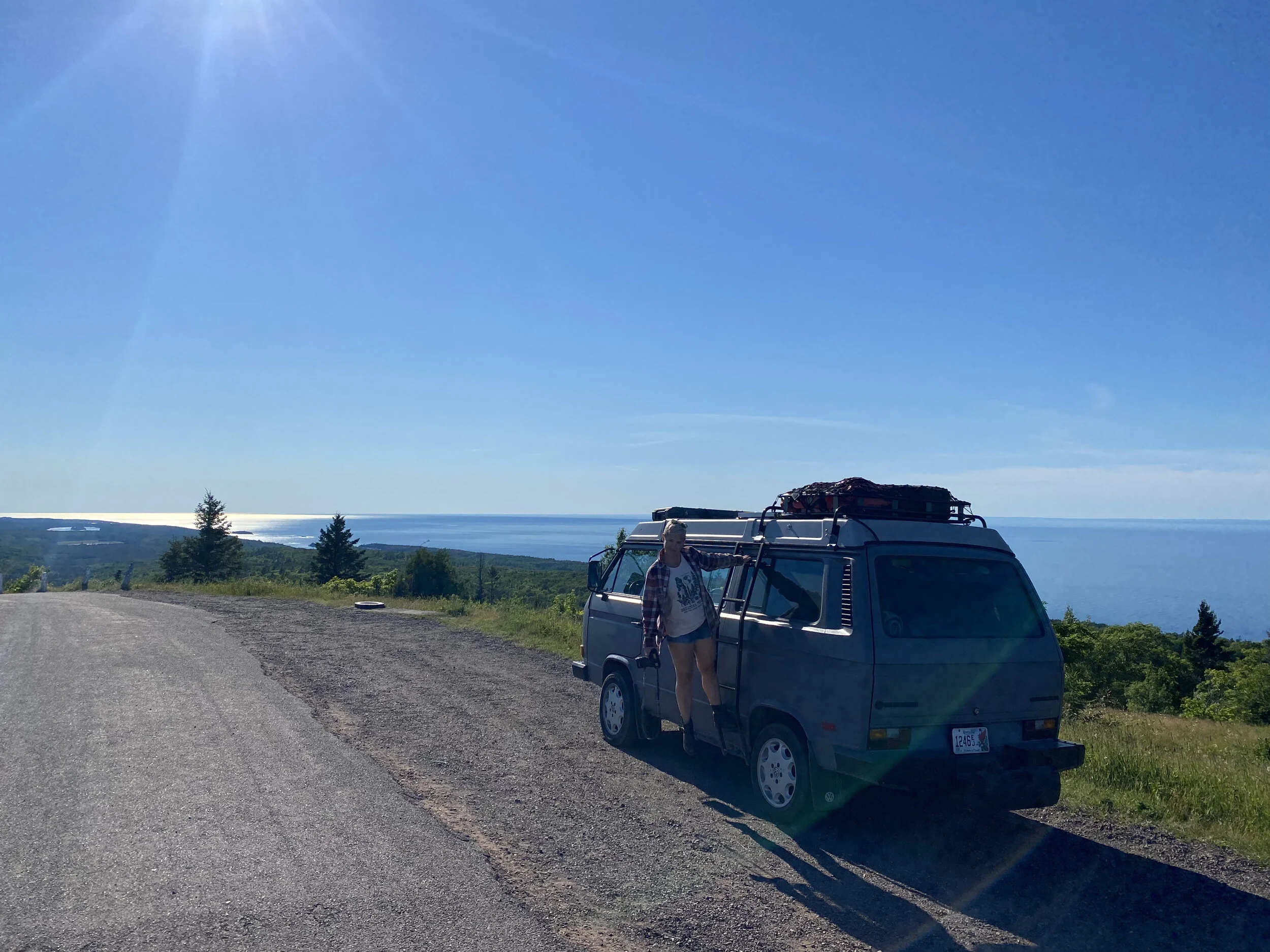
The view from atop Brockway Mountain.
Fanny Hooe Resort and Campground
After a good night’s rest, we headed west to Porcupine Mountains State Park. No hikes were in the cards for us this time — just a quick visit to the Lake of the Clouds. It’s a lake that nestled between two ridges and surrounded by dense forest.
We had finished our tour of Michigan and made a turn toward Wisconsin.

Becky taking in the view of Lake in the Clouds.
Part 3 of our trip up north to come,
-Bink
If you like what you see, check out our map on NanoWhat. You can download a Google map of our Michigan adventures straight to your phone!
